Everything in kick cycles. Underwater you cannot perceive a distance — you can only count kicks. So the survey is laid out and run entirely in kick cycles (one cycle is both legs once — two kicks). The visibility radius r is a kick count; the swim-out is a kick count; nothing is converted to meters in the water. This is not a simplification for the diver's benefit alone — it is the honest unit, because a kick cycle is what the diver can actually measure.
Why a ring, not a single capture. One capture samples one spot — the disk of reef within visibility of one point. That is a sample of one, and a sample of one tells you little about the area and nothing about how much a reading naturally varies. So the survey takes several captures arranged in a ring around a central hub, and reports the average of them. The ring looks at the reef around the hub from several sides, and the spread among the captures is itself information — it is the beginning of knowing how much the number wobbles (Module 7).
Why the captures are spaced — and why exactly six. For the captures to be independent — so that no organism is counted in two of them — the disks must not overlap. Two disks of radius r just touch when their centers are 2r apart, so the captures are spaced 2r around the ring. Place those centers evenly around a hub at that spacing and they fall on a ring whose radius is R = 2r — and here the geometry hands you a fixed fact: equal disks tangent around a ring at twice their own radius number exactly six. This is the hexagonal "six around one" packing — the 2D kissing number — and it is not a parameter you choose. Better visibility makes r larger and the whole ring larger, but the count is always six. Visibility sets the size; geometry sets the number.
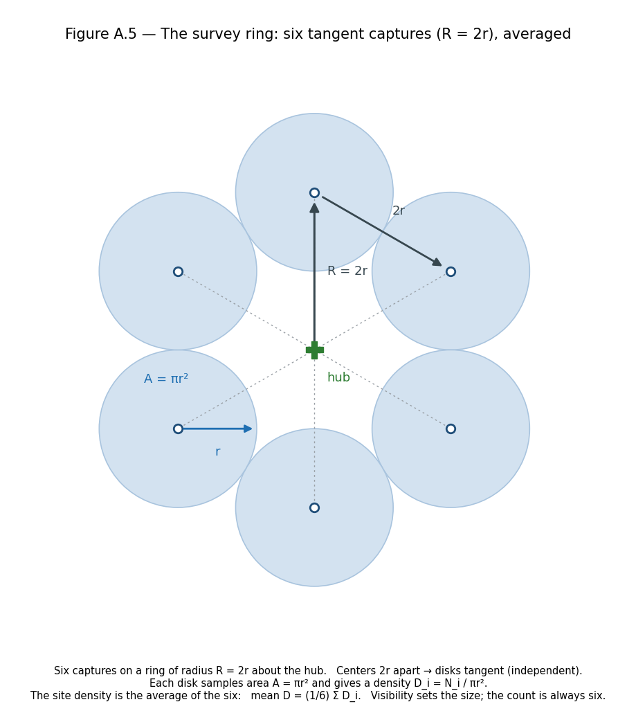
The two numbers and the one rule. This is the whole pattern, and it is light enough to carry underwater without a slate: every leg is 2r kicks, the survey takes six panoramas, and once on the ring you add 60° to the compass at each stop. That is it — 2r kicks, add 60°, six pictures.
The heading sequence. From the hub, swim out on 000° (north) to the first center and take a panorama; then add 60° and swim 2r to the next, and again, around the ring. The headings you set for the legs run 000, 120, 180, 240, 300, 000, 060 — the closing leg bringing you back to the first center. One subtlety worth holding: the heading you swim along the ring's edge is not the same as the bearing from the hub out to a station — the edge headings are offset 60° from the hub bearings, which is why the leg sequence is 120/180/240/300/000/060 rather than 60/120/180/... The rule that keeps it simple is the turn, not the table: add 60° at each stop, and stop when you have six pictures (note that 000° appears twice in the sequence, so count pictures, not compass repeats).
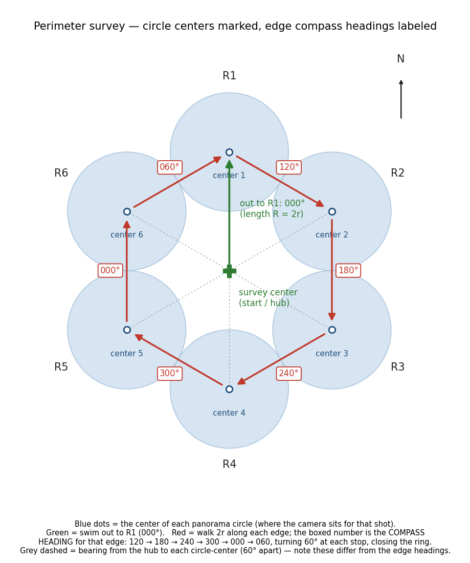
No reel. The survey lays no guide line. In good visibility r is large, so the ring is wide, and a line run out to it would sag, drift in the current, snag, and abrade the reef — a contact-damage risk the survey does not accept. Distance is held by kick count, direction by the compass, and the ring is confirmed closed by returning to the first center on the last leg. The fixed hub and the fixed north do the work a line would otherwise do.
A visual cross-check from the map. Compass and kick count place the stations, but they are not the only reference the demographer has. Because Reef Cartographer is a prerequisite and its map is referenced to the same hub, the demographer arrives already knowing the site's prominent features — a coral head, a channel, a relief edge — and where they sit relative to the hub. Those features are a cross-check on the dead reckoning: if the kick count says a station should fall beside a known feature and it does not, the navigation has drifted and can be corrected on the spot. This does not replace compass and count — you still cannot eyeball a distance underwater — but it catches the systematic drift a current or a biased compass introduces, the kind that a simple average over the ring would not reveal.
What the pattern produces. Each of the six captures gives one density — its count divided by the disk area it sampled — and the survey's reading for the hub is the average of the six. The densities are averaged; the counts are never pooled over a summed area. How that average is formed, normalized, and compared over time is Module 7.